Location: Lincoln, England
bind.remind.deals (what3words)
Sat:53.225309, -0.528765
That first day, my first Psycho Jog to Great Northern Terrace, I thought I would be walking a long way so I began with a bus to the temporary bus station at Tentercroft Street. Then by foot, I crossed the bridge over Sincil Dyke, under Pelham Bridge and on to Great Northern Terrace. We will meet Sincil Dyke again further downstream.
Pedestrian access only on one side of Great Northern Terrace with, every few metres, an entrance/vehicle access to business premises. The road, the area, seems lawless. Cars travel as if there is no longer a speed limit. Large vehicles turn into premises without hesitation. Pedestrians jump forward or back to secure their safety on the precarious footway.
I felt a sense of fear that day as the opposite, northern side of the road is commanded by a tall, long, green cast iron wall.
Why fear?
Well, first, being in the presence of large, imposing, industrial, machine-era objects or buildings. Secondly, not knowing its original, nor its current purpose. Then, what is it shielding or protecting? Which side am I on, the protected side or the protected-from?
In its presence my fear is of these three unknowns.
I could check Google Earth but I don’t.
My perception of time and distance is distorted, my pace seems to slow down. Is this a reasonable response to an edgeland location?
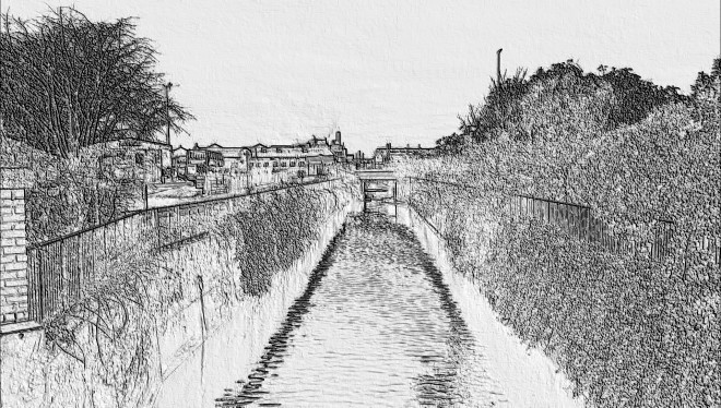
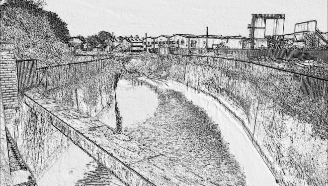
An area opens up to the left, that is, across the road. There is a parking area. I can now see what is behind the tall, long, green cast iron wall. Then, to the right, there are railway sidings (two tracks). A small area with white plastic chairs and a table with a plastic red gingham cloth. There is an entrance to a bus depot/garage. Just a little to the right a bridge crosses Sincil Dyke (also known as Sincil Dike and Sincil Drain). Half way across the bridge I look down at the water, my first view of Sincil Dyke at this point. As I look ahead I see a vast industrial era building and I quickly get a sense of being in the right place for a new Waterways of Lincoln project.
Of this general area, the Lincoln Townscape Assessment (2009) tells us:
[The area’s] use for industry and large out-of-town retail has been influenced by its position on the floodplain as this has left the area relatively undeveloped in comparison with other areas in such close proximity to the city centre.
Buildings are predominantly detached and situated in their own plots, but there are also a few rows of attached properties, and some groups of buildings within industrial estates
Due to its location between the built-up area of the city and its rural fringe there are rural views along the river and drain corridors, views onto the rural south escarpment, and views to the north east onto the Cathedral and upper city on the north escarpment.
These short excerpts describe an area of classic edgelands.
Several buses pass, entering the bus depot behind me. The noise seems to be concentrated here, and their sound and their speed disturbs me. Partly through noise, partly through a localising, enclosed quality which is dominant here, the place seems unsettled, trapped by its own topography.
[Aside]
The bus driver told me, by way of a warning, never to get tattoos on my forearms: “You’ll never be able to wear short sleeved shirts again, unless, maybe, you’re going to some… tattoo convention… something like that.” This was some time ago and I wonder sometimes if he still holds such a strong opinion on this. Last time I saw him he was working on the checkouts in Waitrose.
This was some years ago and it seems tattoos are much more socially acceptable than even just 10 years ago.
Back to my present, standing in the middle of the bridge.
Ahead of me is the Titanic Building, now known as Witham Park House. ‘Titanic Building’ is a much better name than ‘Witham Park House’. This is self evident.
Another noise and turning back on myself again I immediately realise that the railway sidings are in a direct line ahead. That is, it seems immediately apparent that this bridge was built to carry a rail line over the Dyke. This would make sense as the Titanic Building, built for heavy industry, would need railway access.
Permeability and vitality are terms used to describe the characteristics of an urban space.
“Permeability describes the extent to which urban forms permit (or restrict) movement of people and vehicles in different directions”. (Wikipedia at 26/9/2018)
“In the context of urban planning, [the] vitality of a place is its capacity to grow or develop its liveliness and level of economic activity”. (Wikipedia. Same date)
A few words on permeability and vitality from Lincoln Townscape Assessment, and some personal thoughts:
Permeability is limited as the river, drain, railway lines and major road of Broadgate/Pelham Bridge are all large, linear barriers with few crossing points that restrict both pedestrian and vehicular access from one area into another
The edgelands of my childhood were areas of possibility and opportunity. They resonated and, as a result, they shimmered. But the possibility and the opportunity are always obscure, they have to be discerned by a capable mind. Through discernment, a capable mind found in possibility and opportunity a hope of escape, and a liberation was achieved.
Vitality in the Character Area is fairly high due to the numbers of staff and visitors using the area but this is mainly confined to business hours. Some leisure-related uses have extended business hours such as the gymnasium and go-karting centre.
Our location would at first appear to be limiting, a trap, but what we really need to do is to see its potential for liberation while keeping in mind what the Townscape Project informs us about vitality and permeability. The opportunities may well lie outside business hours, and the liberation is one of time, not a topographical escape route, or at least a possibility of one.
Great Northern Terrace is a classic road to nowhere, but as we sidestep it to reach our location we are stepping onto an ancient path which followed Sincil Dyke (also known at this place as the South Delph) as far as South Lincolnshire.
It’s worth spending a while to consider local ley lines. Ley lines undoubtedly exist.
Our ancestral wisdom tells us that it is wise and more convenient to make a journey from A to B by the shortest and most direct route. This alone could explain the abundance of ley lines in Britain, especially those linking settlements and sites of ritual.
At a number of sites in the vicinity there is a distinct feel of intense earth energy. This sense of intense energy certainly seems to be concentrated at our location. There are a number of meeting points and crossing points here: A complex road junction, the bridge across the dyke, a railway sidings which originally continued over the bridge, access to the bus depot, and complex, uneasy, pedestrian access in a number of directions, precarious and unsafe. A site significant in the ancient world has been empowered and intensified by post-industrial development. It is secret, occult knowledge that our location is at the crossing of ley lines. This was recently confirmed by expert dowsing and I am told this is confirmation specifically of the intensity of the location’s water energy, and that this is stronger than any local earth energy.
What is apparent is that any ley lines of water energy would not be linear. Is it possible that the ancient symbol of the serpent, found in some earthworks, is a reference to water energy and to fluid, non-linear leys? Does it seem more likely that fluid, water ley lines, like water itself would follow the path of least resistance, rather than the most direct route?
At the nearby Monk’s Abbey, now a ruin, there is the site of a chalybeate spring. That is, a spring noted for being rich in iron. Gutch and Peacock (Folk-lore Concerning Lincolnshire, 1908) say: “There is a valuable chalybeate spring apparently connected with what was once ‘Monk’s Abbey,’ which is dedicated to St. Mary Magdalen. It is popularly esteemed for its cures of ‘bad legs’ and other physical troubles.”
The spring, when following a downhill course off Lincoln’s escarpment would flow into our watercourse system which includes both the River Witham and Sincil Dyke. The intense water energy survives despite canalizing and rerouting of the waterways themselves over the years.
Clearly more research needs to be done in this area.
[Aside]
We need to be aware that most stone circles and other stone monuments in England are found towards the west of the country. This is because most henges and circles in the east were wooden and have been lost. With the loss of ancient sites we have lost some leys.
Maps and records do show that railway lines were removed in a number of locations, including the crossing of Sincil Dyke.
Wherever railway lines are removed a residual fear remains, a result of rain, steam and speed. Many places with lost railway lines retain the ghost of the line, they were developed as picturesque walks, but the lines were ‘axed’, leaving scars on the land. Beeching’s legacy.
Part of the lost history of the area is very recent history. In an ‘historic’ city like Lincoln we find more attention devoted to the Roman, Medieval and Victorian periods, but increasingly this is catching up with the present.
Elements of post industrial histories were not considered worthy of record and were left to living memory alone. The unimportant remains unrecorded, leaving histories of absence.
In Voice of the Fire (page 306), Alan Moore refers back to earlier chapters:
“Although at times unnerving, this was always the intention, this erasing of a line dividing the incontrovertible from the invented. History, unendingly revised and reinterpreted, is seen upon examination as merely a different class of fiction; becomes hazardous if viewed as having any innate truth beyond this. Still, it is a fiction that we must inhabit. Lacking any territory that is not subjective, we can only live upon the map. All that remains in question is whose map we choose, whether we live within the world’s insistent texts or else replace them with a stronger language of our own.”
In all honesty, I can only offer histories of the present; histories which become place in a seamless progression of nows. Histories of place, or histories as place. And without ambiguities, without uncertainties, without doubts, there really is no point to exploring the edgelands.
In order to take Gertrude Stein’s “there is no there there” into a new context, I need my chosen locations to be in No-place: Utopia. If I know where I am, city centre, suburbia, countryside, without ambiguity, then I’m no longer there. Lincoln High Street follows an ancient route but is no utopia.
Jim Simm 2018
This is a Tract, part of Waterways of Lincoln. This part of the project, 5 Interzones includes music by Jamie Crofts, actions in the form of walks (Treks) and word works by Jim Simm (Tracts). Jim Simm is an unreliable narrator.
Tract:
An area of land.
A publication, a brochure.
© 2018 Jamie Crofts.
For a hard copy of any SOUNDkiosk Tracts, email Jim Simm: jim DOT soundkiosk AT gmail DOT com
